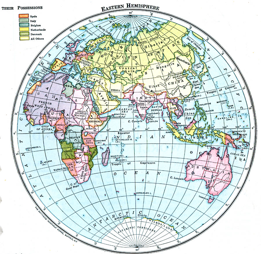
Description: A map of the Eastern Hemisphere in 1916 showing the European colonial territorial possessions at the time. The map is color–coded to show the possessions of Britain in pink, France in purple, Spain in orange, Italy in gray, Belgium in blue, Netherlands in dark yellow, Portugal in dark green, Denmark in medium green, the Russian Empire in light green, and independent nations in light yellow.
Place Names: Eastern Hemisphere, Asia, �Australia, �Europe, �Antarctic
ISO Topic Categories: location,
oceans,
inlandWaters,
boundaries
Keywords: Countries and European Possessions in the Eastern Hemisphere, physical, �political, physical features, location,
oceans,
inlandWaters,
boundaries, Unknown, 1916
Source: Albert Perry Brigham & Charles T. McFarlane, Essentials of Geography (New York, NY: American Book Company, 1916) 241
Map Credit: Courtesy the private collection of Roy Winkelman |
|