Maps Site map
  Maps > Globes and Multi-continent > Eastern Hemisphere
Site Map  

  Record   1   to   9  of   9

A collection of political, physical, and relief maps of the Eastern Hemisphere for use in the K-12 classroom.
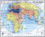
The Old World and Early European Explorers, 1000–1522
A map of Europe, western Asia, and Africa showing the expansion of the known world from the time of Homer (1000 BC) to the voyage of Magellan (1519–1522). The map is color–coded to show the world as it was known to Homer, Ptolemy (AD 150)...

Eastern Hemisphere, 1901
A map from 1901 of the Eastern Hemisphere, showing the Europe, Asia, Africa, and Australia land masses with terrain features and major rivers, the Atlantic and Pacific oceans, and the extent of known land in the south polar region at the time. This m...

Eastern Hemisphere and Ocean Currents, 1902
A map of the Eastern Hemisphere from 1902 showing the Eastern Continent and Australian Continent, the grand divisions of Eurasia (subdivided into Europe and Asia) and Africa, and the major ocean currents of the Atlantic, Arctic, Pacific and Indian oc...

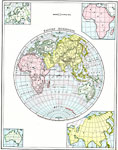
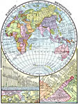
Eastern Hemisphere with Rivers, Lakes, and Mountains, 1906
A map of the Eastern Hemisphere from 1906 showing the continents and country borders of the time, including capital cities. This map has inset maps showing the principal rivers and their lengths given in miles, principal lakes and their area given in...

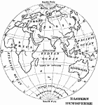
Outline Map of the Eastern Hemisphere, 1909
An outline map of the Eastern Hemisphere from 1909 showing Europe, Asia, Africa, and Australia, major rivers, the Atlantic, Arctic, Pacific and Indian oceans, longitudes from 20° west to 160° east, and the great circles of the equator, Tropic...

A Relief Map of the Eastern Hemisphere, 1909
A relief map of the Eastern Hemisphere from 1909 showing mountain systems and land features, coastlines, islands, and rivers....

Eastern Hemisphere, 1910
A map of the Eastern Hemisphere showing the Eurasian continent subdivided into Europe and Asia, the continents of Africa and Australia, major rivers, the Atlantic, Arctic, Pacific and Indian oceans, longitudes from 20° west to 160° east, and ...

Relief Map of the Eastern Hemisphere, 1910
A relief map of the Eastern Hemisphere from 1910 showing the mountain systems, plateaus, plains, and major rivers of the region....

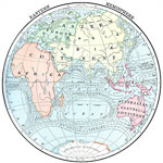
Countries and European Possessions in the Eastern Hemisphere, 1916
A map of the Eastern Hemisphere in 1916 showing the European colonial territorial possessions at the time. The map is color–coded to show the possessions of Britain in pink, France in purple, Spain in orange, Italy in gray, Belgium in blue, Net...


  Maps > Globes and Multi-continent > Eastern Hemisphere
Site Map  

Maps ETC is a part of the Educational Technology Clearinghouse
Produced by the Florida Center for Instructional Technology © 2009
College of Education, University of South Florida