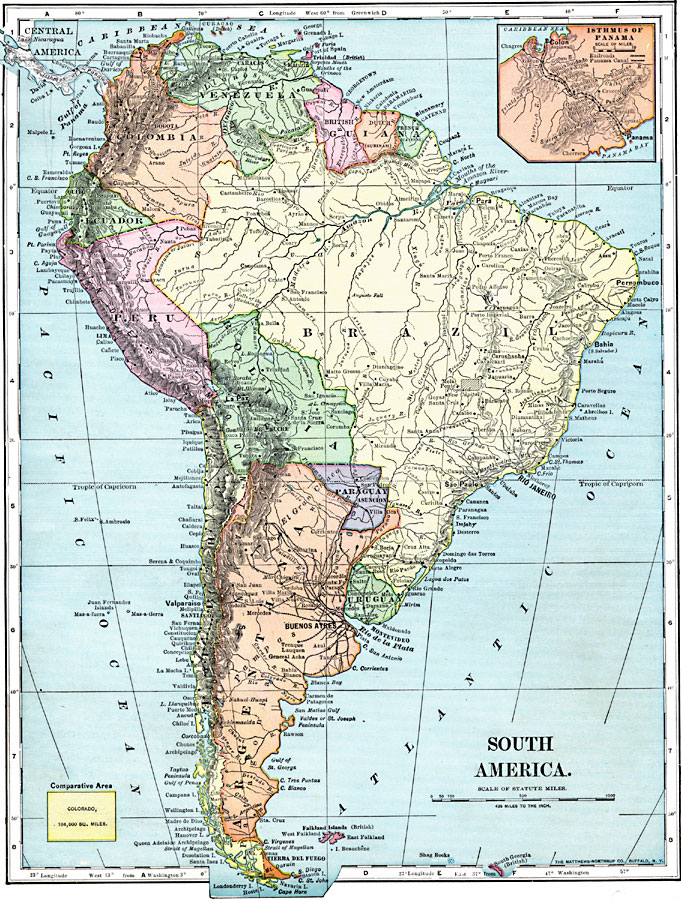
Description: A map of South America from 1899 showing the political boundaries of the time. The map shows capitals, major cities, ports, railroads, rivers, and coastal features. The site of the proposed new capital of Brazil (Brasilia) is shown. Longitudes from Greenwich are given at the top of the map, longitudes from Washington at the bottom. An outline map of Colorado at the same map scale is included to show the comparative area size relationship. An inset map shows the Isthmus of Panama with the railroad and canal route from the Caribbean Sea to the Pacific Ocean.
Place Names: A Complete Map of South America, Argentina, �Bolivia, �Brazil, �Chile, �Columbia, �Ecuador, �Paraguay, �Peru, �Uraguay, �Venezuel
ISO Topic Categories: oceans,
inlandWaters,
location
Keywords: South America, borders, �topographical, �physical, kComparativeArea, physical features,
topographical, country borders, oceans,
inlandWaters,
location, Unknown, 1899
Source: Horace S. Tarbell, LL.D. , The Complete Geography (New York, NY: American Book Company, 1899) 76
Map Credit: Courtesy the private collection of Roy Winkelman |
|