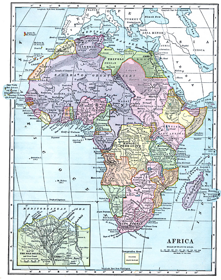
Description: Map of Africa in 1899 showing the colonial possessions of European powers on the continent established at the Berlin Conference of 1885. This map shows major cities and trade centers, railroad routes and canals, major river systems, and sub–basins of the Sahara Desert. An Inset map details the Nile Delta and Suez Canal, showing the Suez and the Canal of Rashid, railroad routes, and the caravan route between Suez and Cairo. An outline map of Colorado is included at the same map scale to show the comparative area size relationship.
Place Names: A Complete Map of Africa, Abyssinia, �Algeria, �Congo, �Egypt, �Ethiopia, �Kamerun, �Kongo, �Lybia, �Madagascar, �Morocco, �Nigeria, �Rhodesia, �Somalia, �South Africa, �Sudan, �Tripoli, Moors Spanish Territory, Tripoli, Italian Somaliland, British East Africa, Kongo Freestate, Upper Guinea, Lower Guinea, Guinea, German East Africa, Cape Colony, Portuguese East Africa, German Southwest Africa, Eritrea, Cairo, Rosetta, Alexandria, Suez, Port Said, Johannesburg
ISO Topic Categories: oceans,
inlandWaters,
location,
boundaries
Keywords: Colonial Africa, borders, �topographical, �physical, kBerlinConference, kComparativeArea, kSuezCanal, physical features,
topographical,
geological, country borders, oceans,
inlandWaters,
location,
boundaries, Unknown, 1899
Source: Horace S. Tarbell, LL.D. , The Complete Geography (New York, NY: American Book Company, 1899) 120
Map Credit: Courtesy the private collection of Roy Winkelman |
|