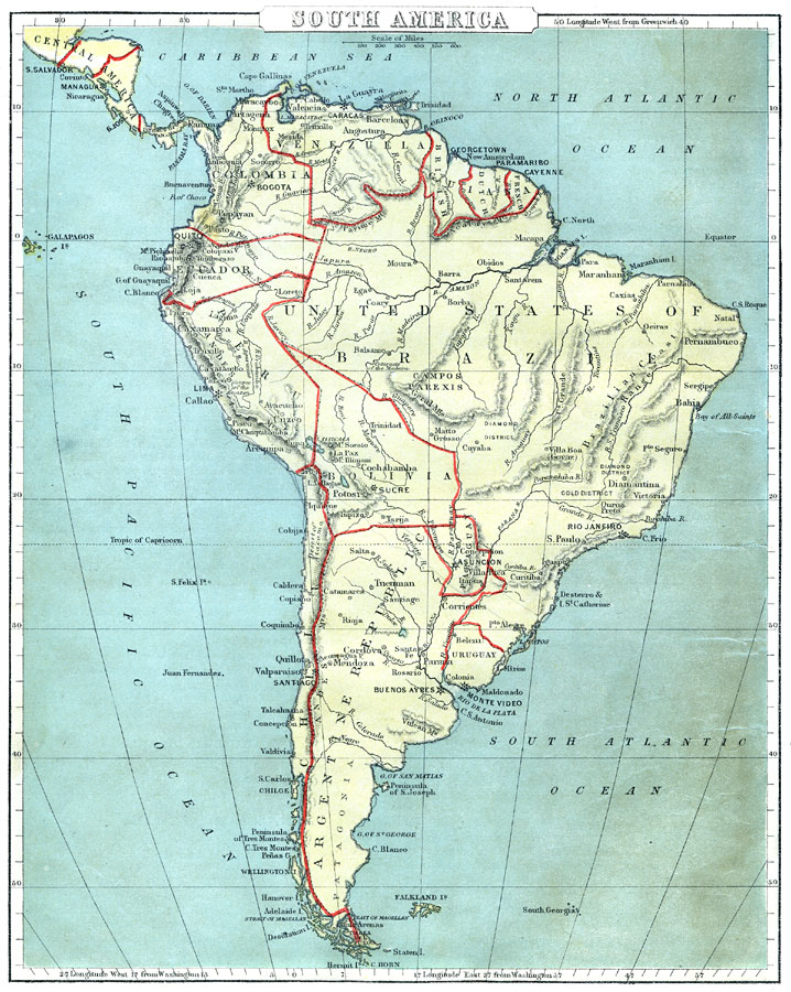
Description: A map of South America from 1888 showing the political boundaries of the time for Columbia (United States of Columbia), Venezuela, the British, Dutch, and French Guiana colonies, United States of Brazil, Ecuador, Peru, Bolivia, Chile, Paraguay, Uruguay, and the Argentine Republic. The map shows capitals, major cities, ports, terrain, rivers, and coastal features. Longitudes from Greenwich are given at the top of the map, longitudes from Washington at the bottom.
Place Names: A Complete Map of South America, Venezuela, �Guiana, �Colombia, �Ecuador, �Peru, �Brazil, �Bolivia, �Paraguay, �Argentine Republic, �Chile, �Urugua
ISO Topic Categories: boundaries,
inlandWaters,
location,
oceans
Keywords: South America, physical, �political, physical features, country borders, boundaries,
inlandWaters,
location,
oceans, Unknown, 1888
Source: , Cornell's Intermediate Geography (New York, New York: American Book Company, 1888) 52
Map Credit: Courtesy the private collection of Roy Winkelman |
|