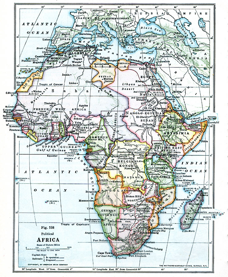
Description: A political map of the African continent in 1916, showing the European territorial claims established at the Berlin Conference in 1885. This map also shows the territorial enclaves of British Walfish Bay in German Southwest Africa, Spanish Guinea in Kamerun (Cameroon), Portuguese Guinea in French Guinea, the Tangier Neutral Zone on the Strait of Gibraltar, and the French Somali Coast on the Strait of Bab–el–Mandeb. This map also shows Libia, formerly known as Tripoli under Ottoman control.
Place Names: A Complete Map of Africa, Cameroon, �Belgian Congo, �South Africa, �Madagascar, �Egypt, �Abyssinia, �Ivory Coast, �Lybia, Libia, Nubia, Gold Coast, Gambia, Rio de Oro, Nigeria, Union of South Africa
ISO Topic Categories: boundaries,
location,
oceans,
inlandWaters
Keywords: Political Colonial Africa, physical, �political, kBerlinConference, physical features, country borders, boundaries,
location,
oceans,
inlandWaters, Unknown, 1916
Source: Albert Perry Brigham & Charles T. McFarlane, Essentials of Geography (New York, NY: American Book Company, 1916) 368
Map Credit: Courtesy the private collection of Roy Winkelman |
|