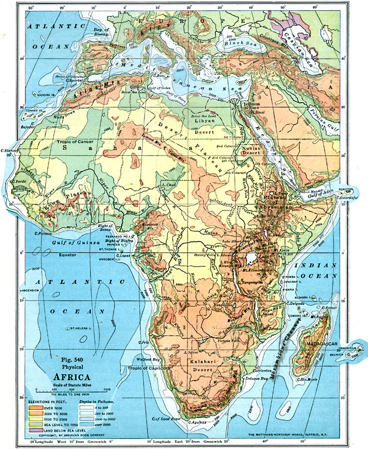
Description: A physical map of the African continent showing general elevations color coded as lands below sea level in purple, sea level to 1000 feet in green, 1000 to 2000 feet in yellow, 2000 to 5000 feet in light orange, and over 5000 feet in dark orange. Bathysphere depths are shown in 100, 1000, 2000, and over 2000 fathom depth increments. This map also shows summit elevations of several prominent mountains in Africa.
Place Names: A Complete Map of Africa, Cameroon, �Belgian Congo, �South Africa, �Madagascar, �Egypt, �Abyssinia, �Ivory Coast, �Lybia, Mt. Kilimanjaro, Mt Kenia, Mt. Elgon, Plateau of Abyssinia, Atlas Mountains, Kong Plateau, Gulf of Guinea
ISO Topic Categories: boundaries,
elevation,
inlandWaters,
location,
oceans
Keywords: Physical Africa, physical, �political, kRelief, physical features, country borders, boundaries,
elevation,
inlandWaters,
location,
oceans, Unknown, 1916
Source: Albert Perry Brigham & Charles T. McFarlane, Essentials of Geography (New York, NY: American Book Company, 1916) 370
Map Credit: Courtesy the private collection of Roy Winkelman |
|