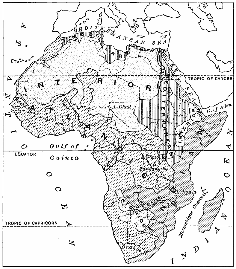
Description: A map of the major drainage basins of the African continent indicating the hydrologic flow to the Atlantic and Gulf of Guinea, the Mediterranean, the Red Sea and Indian Ocean, and the interior basins of the Sahara and Kalahari deserts and Abyssinian Highlands. The map shows major rivers and lakes, and latitudes of the Tropic of Cancer, Tropic of Capricorn, and the Equator.
Place Names: A Complete Map of Africa, Gulf of Guinea, Red Sea, Mediterranean Sea, Indian Ocean, Atlantic Ocean, Gulf of Aden, Mozambique Channel
ISO Topic Categories: boundaries,
geoscientificInformation,
location,
oceans,
inlandWaters
Keywords: Drainage Basins of Africa, hydrological, �physical, �political, kHydrologic, physical features, country borders, drainage basins, boundaries,
geoscientificInformation,
location,
oceans,
inlandWaters, Unknown, 1916
Source: Albert Perry Brigham & Charles T. McFarlane, Essentials of Geography (New York, NY: American Book Company, 1916) 372
Map Credit: Courtesy the private collection of Roy Winkelman |
|