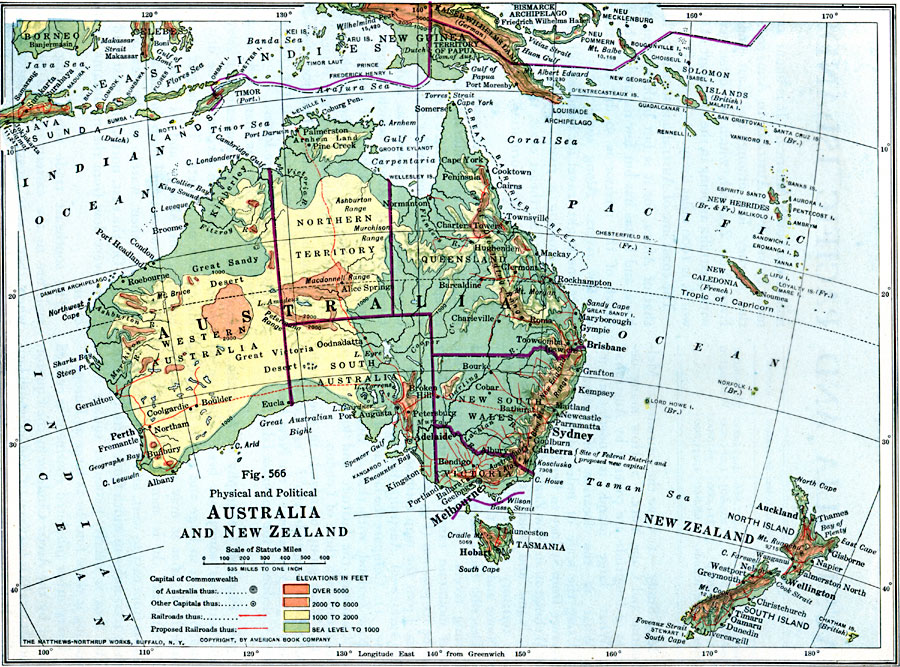
Description: A physical and political map of Australia and New Zealand in 1916 showing the states, territories, and divisions of Australia, including the commonwealth claims to southeastern New Guinea. This map also shows color–coded elevations from sea level to 1000 feet in green, 1000 to 2000 feet in yellow, 2000 to 5000 feet in light orange, and over 5000 feet in dark orange. The map shows major cities and capitals of the commonwealth, including the Australian capital as Melbourne and the proposed site of the Federal District and new capital at Canberra. Existing and proposed railways are shown, as well as major rivers, mountain systems, and landforms.
Place Names: A Complete Map of Australia, Alice Springs, �Brisbane, �Cairns, �Canberra, �Darwin, �Melbourne, �Newcastle, �Sydney, �Townsville, Hobart, Adelaide, Perth
ISO Topic Categories: boundaries,
location,
oceans,
inlandWaters
Keywords: Australia and New Zealand, physical, �political, physical features, country borders, boundaries,
location,
oceans,
inlandWaters, Unknown, 1916
Source: Albert Perry Brigham & Charles T. McFarlane, Essentials of Geography (New York, NY: American Book Company, 1916) 386
Map Credit: Courtesy the private collection of Roy Winkelman |
|