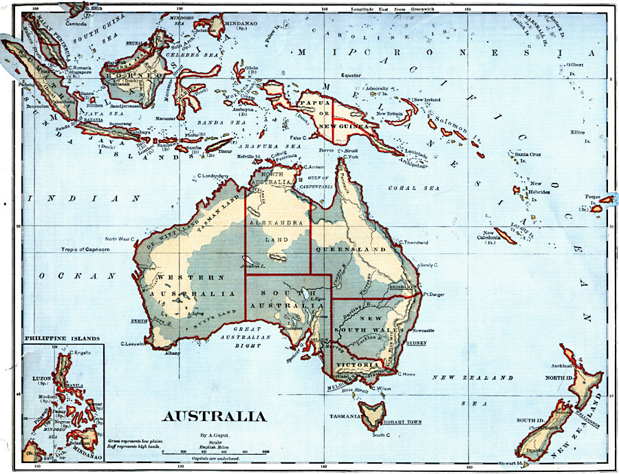
Description: A map of Australia and the Australasian islands in 1882 showing the states and territories of Australia at the time, including De Witt Land and Tasman Land in Western Australia, Alexandra Land and North Australia, Queensland, South Australia, New South Wales, Victoria, and Tasmania. Major cities are shown, with state capitals underlined. This map also shows the European claims to the Australasian Islands, including Sumatra, Borneo, Java, Timor, Celebes, and Papua to the Dutch, Malacca, Singapore, and Feejee (Fiji) Islands to the British, East Timor to Portugal, New Caledonia to France, and Mindanao to Spain. New Zealand is shown on the map, and an inset map shows the Philippine Islands under Spanish authority.
Place Names: A Complete Map of Australia, Perth, �Albany, �Delaide, �Portland, �Tasmania, �Sydney, �Newcastle, �Brisbane, �Papua, �New Guinea, �Borneo, �Java, �Philippine Island
ISO Topic Categories: boundaries,
inlandWaters,
location,
oceans
Keywords: Australia and Australasian Islands, physical, �political, physical features, country borders, boundaries,
inlandWaters,
location,
oceans, Unknown, 1882
Source: , Guyot's New Intermediate Geography (New York, New York: Ivison, Blakeman & Company, 1882) 92
Map Credit: Courtesy the private collection of Roy Winkelman |
|