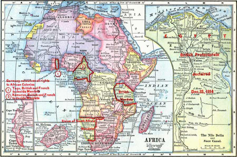
Description: A map from 1919 of Africa showing the territorial changes made after World War I. The map shows the areas ceded by Germany, including Togo and Kamerun to be decided by British and French mandate, German East Africa under British mandate, and German Southwest Africa under the mandate of the Union of South Africa. The map shows territorial boundaries and capitals, principal cities and towns, railroads, deserts, rivers, lakes, and coastal features. Inset maps detail Cape Town and vicinity, the island of St. Helena, and the Nile Delta and Suez Canal under British protectorate (December 18, 1914).
Place Names: A Complete Map of Africa, Algeria, �Congo, �Egypt, �Ethiopia, �Lybia, �Madagascar, �Nigeria, �Somalia, �South Africa, �Suda
ISO Topic Categories: boundaries,
inlandWaters,
location,
oceans
Keywords: Africa, physical, �political, �borders, �boundaries, �historical, �World War I, �WWI, �physical features, country borders, WWI, boundaries,
inlandWaters,
location,
oceans, Unknown, 1919
Source: Merton M. Wilner, A New Atlas of the New World Corrected According to the Peace Terms Together with a Graphic Story of the Great War 1914-1919 (New York, NY: The Christian Herald, 1919) 31
Map Credit: Courtesy the private collection of Roy Winkelman |
|