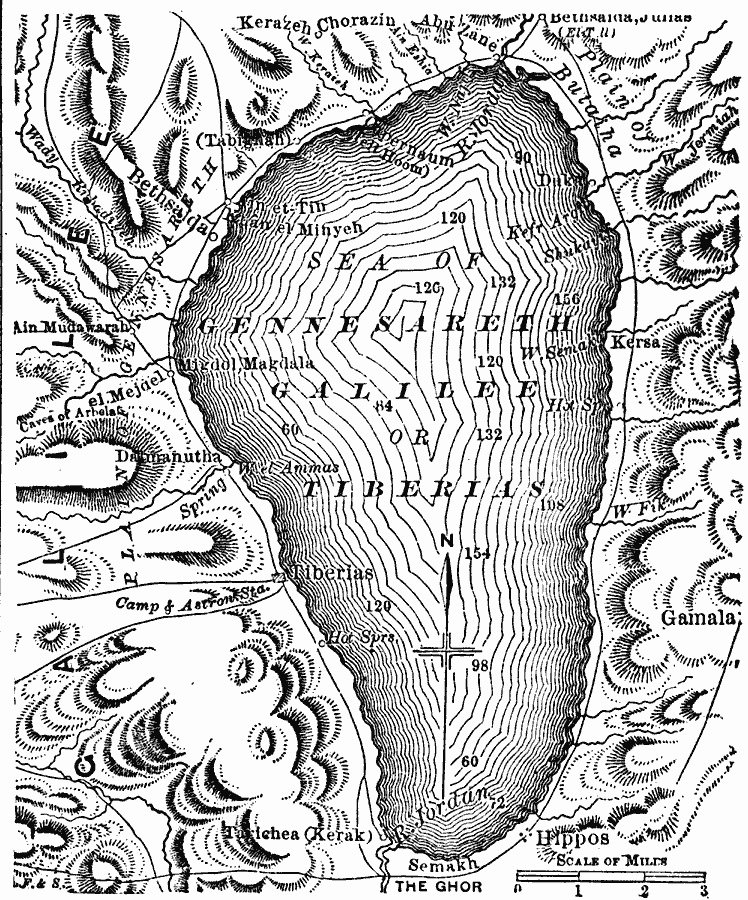
Description: A map from 1881 of the Sea of Gennesareth, also known as the Sea of Galilee or Lake Tiberias, the largest freshwater lake in Israel. The map shows the cities and towns on the shores of the lake, roads, terrain features, rivers and springs that drain into the lake, and water depths in various locations.
Place Names: Israel, Sea of Gennesaret, �Bethdaida, �Kersa, �Gamal
ISO Topic Categories: location,
inlandWaters,
transportation
Keywords: Sea of Gennesareth or Galilee, physical, �transportation, physical features, roads, location,
inlandWaters,
transportation, Unknown, 1881
Source: W. H. De Puy, People's Cyclopedia of Universal Knowledge Vol 1 (New York, NY: Phillips & Hunt, 1881) 786
Map Credit: Courtesy the private collection of Roy Winkelman |
|