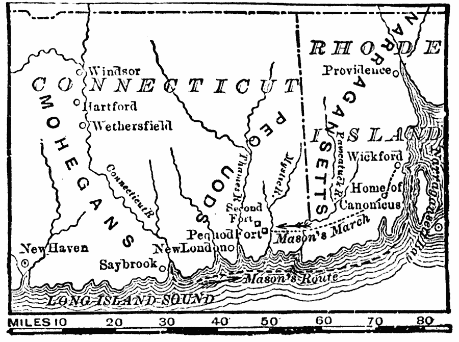
Description: A map of southern Connecticut and Rhode Island showing the area of the Pequot War (1636–1638) between the allied Massachusetts and Plymouth colonies against the Pequot tribe. The map shows the territories of the Mohegans, Narragansetts, and Pequots, the English settlements at the time, and the route of the campaign (1637) of Captain John Mason from Fort Saybrook up the coast to Wickford, Rhode Island, then overland to the Pequot Fort on the Mystic River, site of the Mystic Massacre.
Place Names: Early America 1400-1800, Connecticut, �Rhode Island, �Hartford, �New Haven, �Providence, �Colonial America, �Native Americans, �Pequot Wa
ISO Topic Categories: transportation,
location,
oceans,
inlandWaters,
boundaries
Keywords: Pequod (Pequot) War, physical, �political, �transportation, kNativeAmerican, physical features, major political subdivisions, water routes, transportation,
location,
oceans,
inlandWaters,
boundaries, Unknown, 1636–1638
Source: W. H. De Puy, People's Cyclopedia of Universal Knowledge Vol 1 (New York, NY: Phillips & Hunt, 1881) 953
Map Credit: Courtesy the private collection of Roy Winkelman |
|