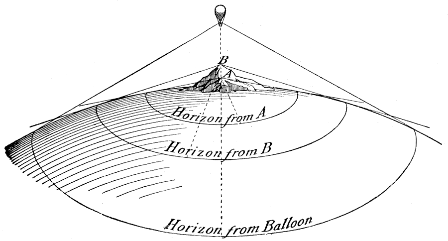
Description: A diagram from 1908 showing the different horizons which may be seen from different elevations. "The globular earth is so large that we can see very little of its surface at any one moment, and that little appears flat. If we climb a tree or go up on a housetop, we can see more of the earth's surface than we can from the ground. [...] In all places, however, we see a line in the distance where the earth and sky seem to meet. That line is known as the horizon." — Dodge, 1908, p.10.
Place Names: Map Drawing,
ISO Topic Categories: oceans
Keywords: Horizons, physical, �horizons, physical features, oceans, Unknown, 1908
Source: Richard Elwood Dodge, Dodge's Advanced Geography (New York, NY: Rand McNally & Company, 1908) 10
Map Credit: Courtesy the private collection of Roy Winkelman |
|