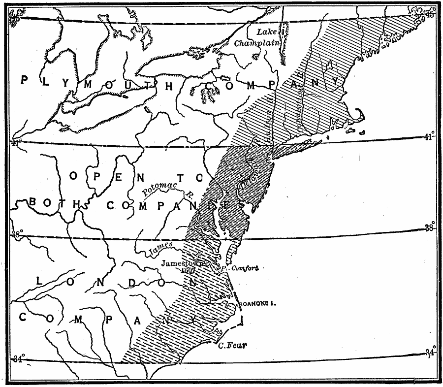
Description: A map of eastern North America showing the land grants of the Plymouth Company and London Company established by charter of King James I in 1606. The map shows the London Company grant, which included Jamestown (1607), extending from 34° N latitude to 38° N latitude, the Plymouth Company grant from 41° N to 45° N, and the territory from 38° N to 41° N open to both companies.
Place Names: Early America 1400-1800, London Company, �Plymouth Company, �Colonial America, �Grant
ISO Topic Categories: boundaries,
inlandWaters,
location,
oceans
Keywords: Crown Grants To Trading Companies in North America, physical, physical features, boundaries,
inlandWaters,
location,
oceans, Unknown, 1606
Source: Robert Hall, Harriet Smither, and Clarence Ousley, A History of the United States (Dallas, TX: The Southern Publishing Company, 1920) 39
Map Credit: Courtesy the private collection of Roy Winkelman |
|