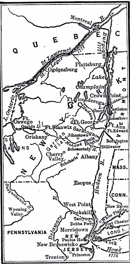
Description: A map showing the routes of the British campaigns of Burgoyne and St. Leger in 1777 during the American Revolutionary War. The map shows the route of Burgoyne from Montreal to Lake Champlain, Fort Ticonderoga, Shenesboro, Fort Edward, Bennington, Bemis Heights, and Saratoga, and the route of St. Leger from Montreal up the St. Lawrence to Lake Ontario, Lake Oneida, Fort Stanwix, and Oriskany.
Place Names: Early America 1400-1800, New York, �Pennsylvania, �West Point, �Massachusetts, �Connecticut, �Albany, �Saratoga, �Ogdensburg, �American Revolutio
ISO Topic Categories: oceans,
location,
inlandWaters,
boundaries
Keywords: Routes of Burgoyne and St. Leger, physical, �political, kAmericanRevolution, physical features, major political subdivisions, oceans,
location,
inlandWaters,
boundaries, Unknown, 1777
Source: Robert Hall, Harriet Smither, and Clarence Ousley, A History of the United States (Dallas, TX: The Southern Publishing Company, 1920) 152
Map Credit: Courtesy the private collection of Roy Winkelman |
|