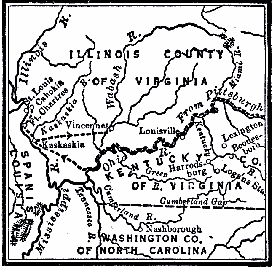
Description: A map of the Ohio country where in 1778–1779 George Rogers Clark led the Illinois Campaign to capture the British stronghold at Vincennes, marking an end to British power in the west. The map shows Clark's route from Pittsburgh along the Ohio River to the British Fort Kaskaskia on the Mississippi River (1778) and British Fort Vincennes on the Wabash River (1779).
Place Names: Early America 1400-1800, Illinois Country, �Kentucky, �North Carolina, �Louisville, �American Revolutio
ISO Topic Categories: intelligenceMilitary,
inlandWaters,
location,
oceans,
boundaries
Keywords: Route of George Rogers Clark, transportation, �historical, �physical, �political, kAmericanRevolution, physical features, county borders, American Revolution, intelligenceMilitary,
inlandWaters,
location,
oceans,
boundaries, Unknown, 1777–1779
Source: Robert Hall, Harriet Smither, and Clarence Ousley, A History of the United States (Dallas, TX: The Southern Publishing Company, 1920) 163
Map Credit: Courtesy the private collection of Roy Winkelman |
|