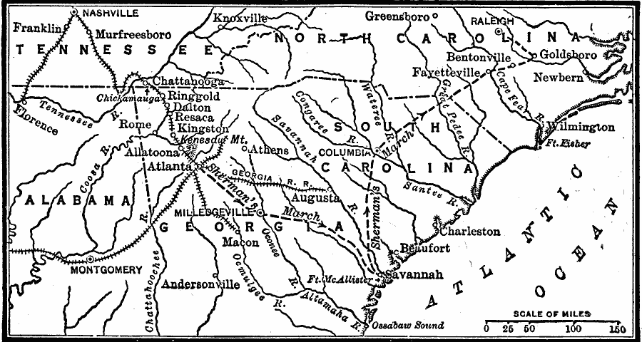
Description: A map of Georgia, South Carolina, and North Carolina showing the routes of Union General Sherman's ‘March to the Sea’ from Atlanta to Savannah (November 15 to December 21, 1864), and his march to Raleigh. The map shows the area to the northwest of Atlanta, including the battle site of Chickamauga near Chattanooga at the beginning of the campaign, state capitals, including Milledgeville, Georgia, major cities and towns, the prisoner of war camp at Andersonville, the strategic railroad network extending to Nashville and Montgomery, and rivers of the area.
Place Names: Civil War, Columbia, �Fayetteville, �Macon, �Atlanta, �Athens, �Kingsto
ISO Topic Categories: boundaries,
inlandWaters,
oceans,
location,
transportation,
intelligenceMilitary
Keywords: Sherman's March to the Sea, physical, �transportation, �political, physical features, major political subdivisions, railroads, boundaries,
inlandWaters,
oceans,
location,
transportation,
intelligenceMilitary, Unknown, 1864
Source: Robert Hall, Harriet Smither, and Clarence Ousley, A History of the United States (Dallas, TX: The Southern Publishing Company, 1920) 378
Map Credit: Courtesy the private collection of Roy Winkelman |
|