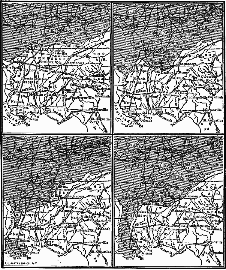
Description: A series of maps of the southeastern states showing the gradual southward movement of the Confederate defenses during the American Civil War, keyed to show the Confederate–held territories at the outset of the war and the advance of the Union line to the eventual splitting the Confederacy.
Place Names: Civil War, Tennessee, �Florida, �Mississippi, �Louisiana, �Alabama, �Georgia, �Confederate territory, �Conderate defense
ISO Topic Categories: inlandWaters,
location,
oceans,
intelligenceMilitary,
transportation,
boundaries
Keywords: Southward Movement of Confederate Defenses, physical, �political, �transportation, physical features, major political subdivisions, railroads, inlandWaters,
location,
oceans,
intelligenceMilitary,
transportation,
boundaries, Unknown, 1861–1865
Source: Robert Hall, Harriet Smither, and Clarence Ousley, A History of the United States (Dallas, TX: The Southern Publishing Company, 1920) 380
Map Credit: Courtesy the private collection of Roy Winkelman |
|