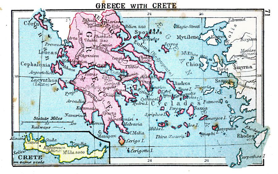
Description: A map of Greece in 1920, showing major cities and rivers, with an inset map detail of the island of Crete.
Place Names: Greece, Thessaly, �Greece, �Ionian Islands, �Crete, �Thebes, �Athens, �Andro
ISO Topic Categories: boundaries,
inlandWaters,
location,
oceans,
transportation
Keywords: Greece with Crete, physical, �political, �transportation, physical features, country borders, railroads, boundaries,
inlandWaters,
location,
oceans,
transportation, Unknown, 1920
Source: , Asprey's Atlas of the World (London, England: Asprey and Co., Ltd., 1920) 71
Map Credit: Courtesy the private collection of Roy Winkelman |
|