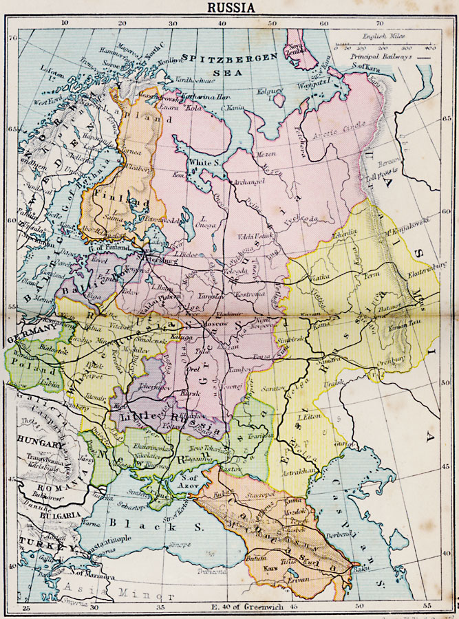
Description: A map from 1920 of western Russia showing the political divisions within the country at the time. The map is color–coded to show the boundaries of European Russia, including the territories of Finland, the Baltic Provinces, Poland, White Russia, Great Russia, Little Russia, New Russia, East Russia, and Caucasia. The map shows the railway network with connections to western Europe and Asia, major cities and towns, the Ural, Carpathian, and Caucasus mountain systems, rivers, lakes, and the seas, including the Spitzbergen, Baltic, Caspian, Black, and the Sea of Azov.
Place Names: Russia, Mezen, �Moscow, �Kursk, �Saratov, �Archangel, �Kar
ISO Topic Categories: boundaries,
inlandWaters,
location,
oceans
Keywords: Russia, physical, �political, physical features, country borders,
major political subdivisions, boundaries,
inlandWaters,
location,
oceans, Unknown, 1920
Source: , Asprey's Atlas of the World (London, England: Asprey and Co., Ltd., 1920) 72
Map Credit: Courtesy the private collection of Roy Winkelman |
|