Maps Site map
  Maps > Asia > Russia
Site Map  

  Record   1   to   10  of   20

Historic and contemporary maps of Russia, including political and physical maps, early empires, territorial expansion, and city plans.

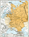
Russia, 1725
A map of Great Russia in 1725 at the time of the death of Peter I (Peter the Great). The map is color–coded to show territories acquired during his reign, including Livonia and neighboring islands in the Baltic, Ingria, Carelia, and the souther...

Russian Territorial Expansion , 1725–1795
A map of the European Russia showing the territorial expansion between the death of Peter the Great (1725) to prior to the end of the reign of Catherine II (Catherine the Great) in 1796. The map is color–coded to show the Russian territory in 1...

Napoleon's Invasion of Russia, 1812
A map of Western Russia at the time of Napoleon's invasion in 1812. The map shows the borders of Russia, Prussia, and the Duchy of Warsaw at the time, the city of Kovno where Napoleon crossed the River Niemen on June 24, 1812, the crossing site at Gr...

Sketch Map of the Russian Campaign, 1812
A sketch map of Western Russia at the time of Napoleon's invasion in 1812. "The disastrous campaign which opened in June, 1812, was conducted on so vast a scale that a brief sketch can provide only the slightest conception of the magnitude of th...

Russian Campaign of Napoleon, 1812
The march of Napoleon to and from Moscow in 1812....

Plan of Irkutsk, 1903
A city plan of Irkutsk, Russia, from 1903, showing the Angara River, the major thoroughfares, bridges, town buildings, and historic sites. The plan is number–keyed to show the locations of important buildings of the city, including churches, ca...

Kamchatka Peninsula, 1903
A map from 1903 of the Kamchatka Peninsula in the Russian Far East. The map shows cities, towns and ports, terrain, rivers, coastal features, and surrounding seas of the peninsula....

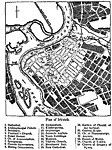
Plan of Nijni-Novgorod, 1903
A plan of the Russian city of Nijni–Novgorod (Nizhny–Novgorod, earlier Gorky) from 1903, showing streets, rivers, railways and station, wharfs, and landmarks. On this map, the bridge across the Oka River is shown as a bridge of boats, or ...

Nova Zembla, 1903
A sketch map from 1903 of the Russian islands of Nova Zembla (Novaya Zemlya) in the Arctic Ocean. Nova Zembla is an archipelago separated from the continent by the Kara Strait, with the two main islands, the northern Barents Land (Severny) and southe...

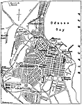
Plan of Odessa, 1903
A city plan of Odessa, Ukraine, from 1903 showing the shoreline of the Black Sea, the major thoroughfares, railroads and railroad stations, the harbors on Odessa Bay, churches, hospitals, military installations, cemeteries, the botanical garden, and ...

Next Last


  Maps > Asia > Russia
Site Map  

Maps ETC is a part of the Educational Technology Clearinghouse
Produced by the Florida Center for Instructional Technology © 2009
College of Education, University of South Florida