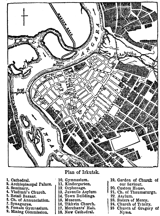
Description: A city plan of Irkutsk, Russia, from 1903, showing the Angara River, the major thoroughfares, bridges, town buildings, and historic sites. The plan is number–keyed to show the locations of important buildings of the city, including churches, cathedral and synagogue, schools, the Archiepiscopal Palace, museum, and others.
Place Names: Russia, Angara River, �Balagansk, �Glaskovsk, �Kirensk, �Nizhne-Udinsk, �Saint Petersburg, �Siberia, �Verkholens
ISO Topic Categories: oceans,
location,
inlandWaters
Keywords: Plan of Irkutsk, physical, �political, �transportation, county borders, roads,
water routes, oceans,
location,
inlandWaters, Unknown, 1903
Source: Spencer Baynes, LL.D., and W. Robertson Smith, LL.D., eds., The Encyclopedia Britannica vol. 13 (New York, NY: The Werner Company, 1903) 277
Map Credit: Courtesy the private collection of Roy Winkelman |
|