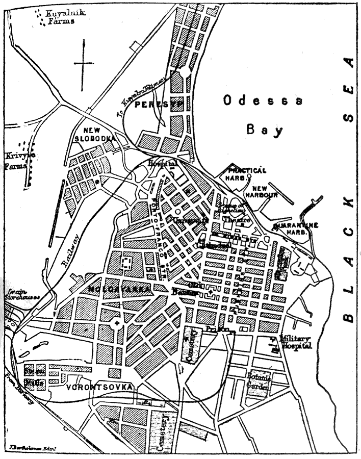
Description: A city plan of Odessa, Ukraine, from 1903 showing the shoreline of the Black Sea, the major thoroughfares, railroads and railroad stations, the harbors on Odessa Bay, churches, hospitals, military installations, cemeteries, the botanical garden, and other city landmarks.
Place Names: Russia, Odessa, �Odessa Bay, �Black Se
ISO Topic Categories: structure,
transportation,
inlandWaters
Keywords: Plan of Odessa, physical, �transportation, physical features, roads,
railroads, structure,
transportation,
inlandWaters, Unknown,1903
Source: Day Otis Kellogg, Encyclopædia Britannica Vol. XVII (New York, NY: Werner Company, 1903) 725
Map Credit: Courtesy the private collection of Roy Winkelman |
|