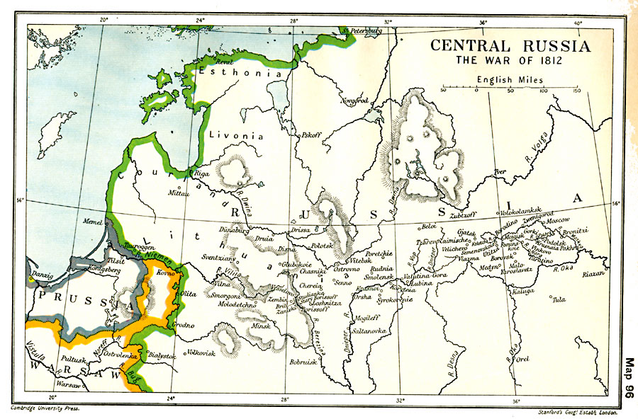
Description: A map of Western Russia at the time of Napoleon's invasion in 1812. The map shows the borders of Russia, Prussia, and the Duchy of Warsaw at the time, the city of Kovno where Napoleon crossed the River Niemen on June 24, 1812, the crossing site at Grodno, and the cities of Vilna, Smolensk, Borodino, Moscow (entered on September 14, 1812), the retreat route to Malo–Yaroslavetz, Viazma, Krasnoi, and the crossing of the River Berezina (November).
Place Names: Russia, Courland, �Esthonia, �Lithuania, �Livonia, �Moscow, �St. Petersbur
ISO Topic Categories: oceans,
location,
inlandWaters,
boundaries
Keywords: Napoleon's Invasion of Russia, political, �historical, kNapoleonicWars, country borders,
major political subdivisions,
local jurisdictions, historical event,
other military, oceans,
location,
inlandWaters,
boundaries, Unknown, 1812
Source: Ward, Prothero, and Leathes, The Cambridge Modern History Atlas (New York, NY: The Macmillan Company, 1912)
Map Credit: Courtesy the private collection of Roy Winkelman |
|