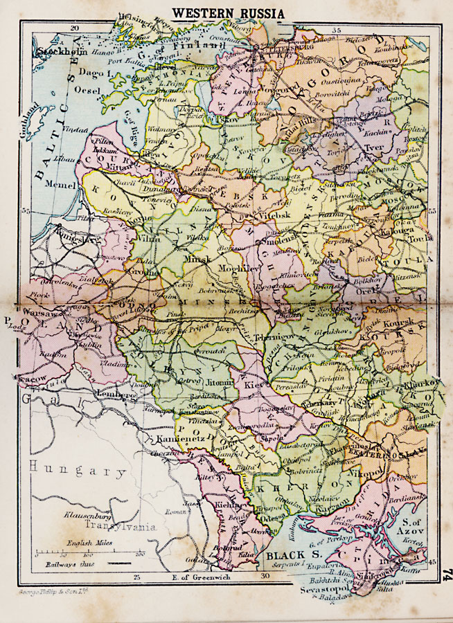
Description: A map from 1920 of the western portion of Russia from St. Petersburg on the Gulf of Finland to the Crimean Peninsula on the Black Sea, and east to Moscow. The map shows the political boundaries within Russia at the time, major cities and ports, railways, and rivers of the region.
Place Names: Russia, Tver, �Noygorod, �Toula, �Minsk, �Moghilev, �Mittan, �Warsaw, �Kiev, �Kours
ISO Topic Categories: boundaries,
inlandWaters,
location,
oceans,
transportation
Keywords: Western Russia, physical, �political, �transportation, physical features, country borders,
major political subdivisions, railroads, boundaries,
inlandWaters,
location,
oceans,
transportation, Unknown, 1920
Source: , Asprey's Atlas of the World (London, England: Asprey and Co., Ltd., 1920) 74
Map Credit: Courtesy the private collection of Roy Winkelman |
|