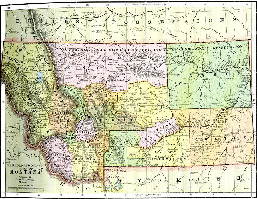
Description: A map from 1892 of Montana showing the capital of Helena, counties and county seats, major cities and towns, Indian reservations, railroads, rivers, and mountains. An inset map details Yellowstone National Park, primarily in Wyoming.
Place Names: Montana, Butte, �Missoula, �Bozeman, �Fort Bento
ISO Topic Categories: boundaries,
inlandWaters,
location,
transportation
Keywords: Montana, physical, �political, �transportation, kNativeAmerican, physical features, county borders, railroads, boundaries,
inlandWaters,
location,
transportation, Unknown, 1892
Source: , The American Republic (Chicago, IL: John W. Iliff and Co., 1892) 69
Map Credit: Courtesy the private collection of Roy Winkelman |
|