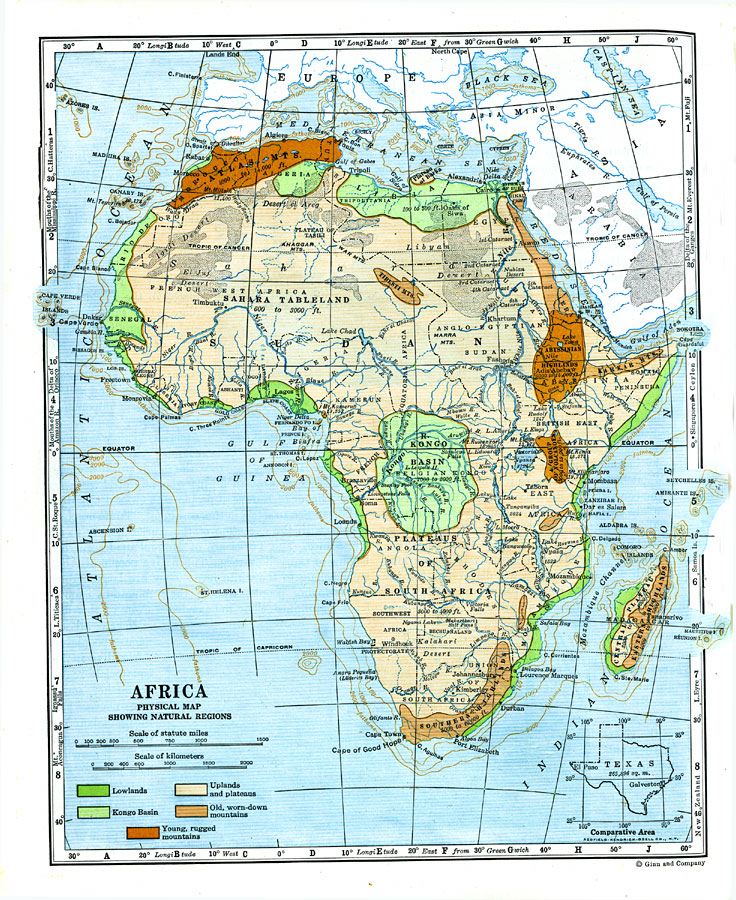
Description: A map from 1920 of Africa and Madagascar showing principal physical features and natural regions. The map is color–coded to show lowlands, uplands and plateaus, the Kongo basin, the older, worn down mountains, and young, rugged mountains. The map shows river and lake systems, and water depths at the 100, 1000, and 2000 fathom lines. Comparative latitudes for other natural features in the world are given in the side margins, and an outline map of Texas at the same map scale is given to show relative area size.
Place Names: A Complete Map of Africa, South Africa, �Madagascar, �Somalia, �Egypt, �Lybia, �Algeria, �Cong
ISO Topic Categories: location,
inlandWaters,
oceans
Keywords: Natural Regions of Africa, physical, �hydrological, physical features, water depths, location,
inlandWaters,
oceans, Unknown, 1920
Source: Wallace W. Atwood, New Geography: Book Two (Boston, MA: Ginn and Company, 1920) 218
Map Credit: Courtesy the private collection of Roy Winkelman |
|