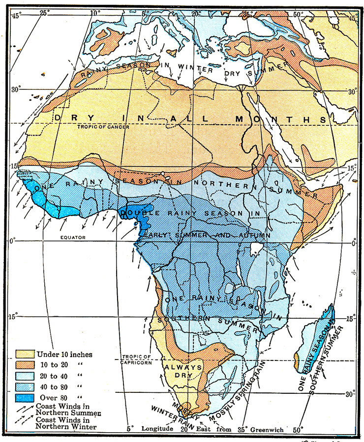
Description: A map from 1920 of Africa and Madagascar showing the mean annual rainfall distribution given in inches, seasonal variations in precipitation, and seasonal costal wind direction. The map is color–coded to show annual precipitation ranging from under 10 inches to over 80 inches, and distinguishes summer coastal winds (solid lines) and winter coastal winds (dashed lines).
Place Names: A Complete Map of Africa, Egypt, �South Afric
ISO Topic Categories: inlandWaters,
location,
climatologyMeteorologyAtmosphere
Keywords: Annual Rainfall in Africa, physical, �meteorological, kClimate, kPrecipitation, physical features, rainfall,
winds, inlandWaters,
location,
climatologyMeteorologyAtmosphere, Unknown, 1920
Source: Wallace W. Atwood, New Geography: Book Two (Boston, MA: Ginn and Company, 1920) 230
Map Credit: Courtesy the private collection of Roy Winkelman |
|