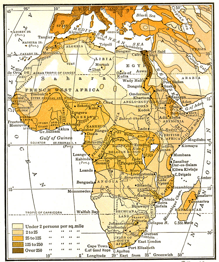
Description: A map from 1920 of Africa and Madagascar showing the population distribution in the region, keyed to show densities ranging from under 2 persons per square mile to over 250 persons per square mile.
Place Names: A Complete Map of Africa, Egypt, �Madagascar, �South Africa, �Algeri
ISO Topic Categories: boundaries,
inlandWaters,
location,
oceans,
society
Keywords: Population Distributions in Africa, physical, �political, �statistical, physical features, country borders, population, boundaries,
inlandWaters,
location,
oceans,
society, Unknown, 1920
Source: Wallace W. Atwood, New Geography: Book Two (Boston, MA: Ginn and Company, 1920) 230
Map Credit: Courtesy the private collection of Roy Winkelman |
|