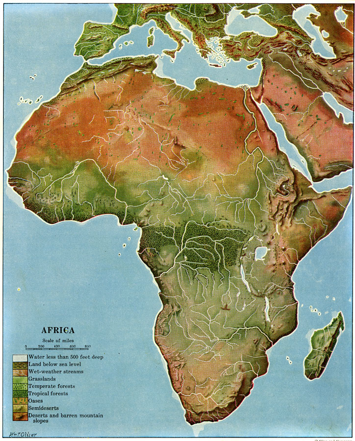
Description: A color relief map of the African continent showing regional vegetation and terrain including lands below sea level, grasslands, temperate and tropical forests, oases, semideserts, and deserts and barren mountain slopes. The map also shows wet weather streams and major rivers, lakes, and waters less than 500 feet deep.
Place Names: A Complete Map of Africa, Madagasca
ISO Topic Categories: location,
inlandWaters
Keywords: Land Regions of Africa, physical, kBiodiversity, kRelief, physical features, location,
inlandWaters, Unknown, 1920
Source: Wallace W. Atwood, New Geography: Book Two (Boston, Massachusetts: Ginn and Company, 1920) Between230 and 231
Map Credit: Courtesy the private collection of Roy Winkelman |
|