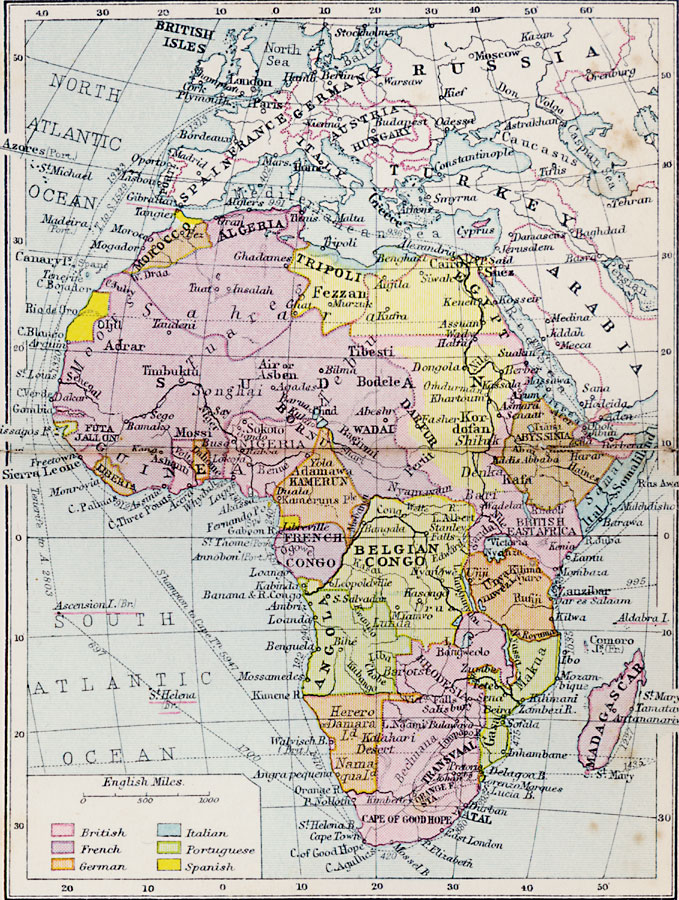
Description: A map of Africa in 1920 showing colonial possessions of the British, French, Italian, Portuguese, Spanish, and Belgians, including the former German colonies, lost after WWI, per the Treaty of Versailles. This map shows major cities and trade centers, major rivers, deserts, and landforms, and shipping routes between major ports measured in English miles. African Tribes are labeled in italics.
Place Names: A Complete Map of Africa, Morocco, �Algeria, �Tripoli, �Fezzan, �Egypt, �Adrar, �Guinea, �French Congo, �Angola, �Belgian Congo, �Transvaal, �Gasa, �Madagascar, �Darfu
ISO Topic Categories: boundaries,
inlandWaters,
location,
oceans
Keywords: Post-WWI Africa, physical, �political, �British, �French, �German, �Italian, �Portuguese, �Spanish, kTransportation, kVersailles, physical features, country borders, boundaries,
inlandWaters,
location,
oceans, Unknown, 1920
Source: , Asprey's Atlas of the World (London, England: Asprey and Co., Ltd., 1920) 98
Map Credit: Courtesy the private collection of Roy Winkelman |
|