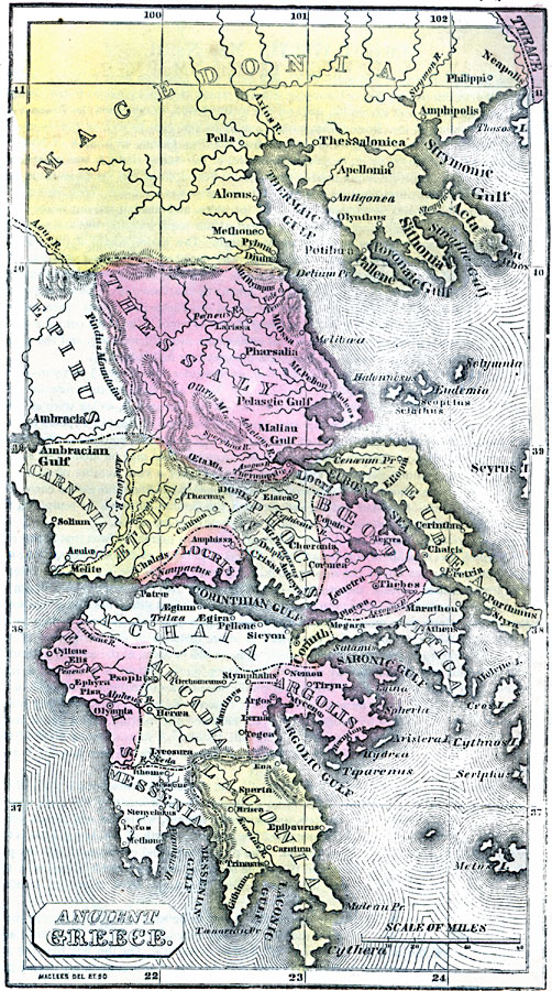
Description: A map of Ancient Greece, circa 1500 BC, showing the territories of the Peloponnese peninsula and southern Balkan peninsula, including the southern portions of Macedonia and Epirus. The map shows important cities of the time, rivers, islands, coastal features, and terrain.
Place Names: Greece, Alexandroupolis, �Athens, �Chalkis, �Elefsis, �Irakleion, �Kavala, �Kerkyra, �Patrai, �Thessaloniki, �Volo
ISO Topic Categories: inlandWaters,
location,
oceans
Keywords: Ancient Greece, historical, kAncientGreece, country borders, inlandWaters,
location,
oceans, Unknown, 1500 B.C.
Source: Marcius Willson, Willson's Outlines of History (New York, NY: Ivison & Phinney, 1859) 565
Map Credit: Courtesy the private collection of Roy Winkelman |
|