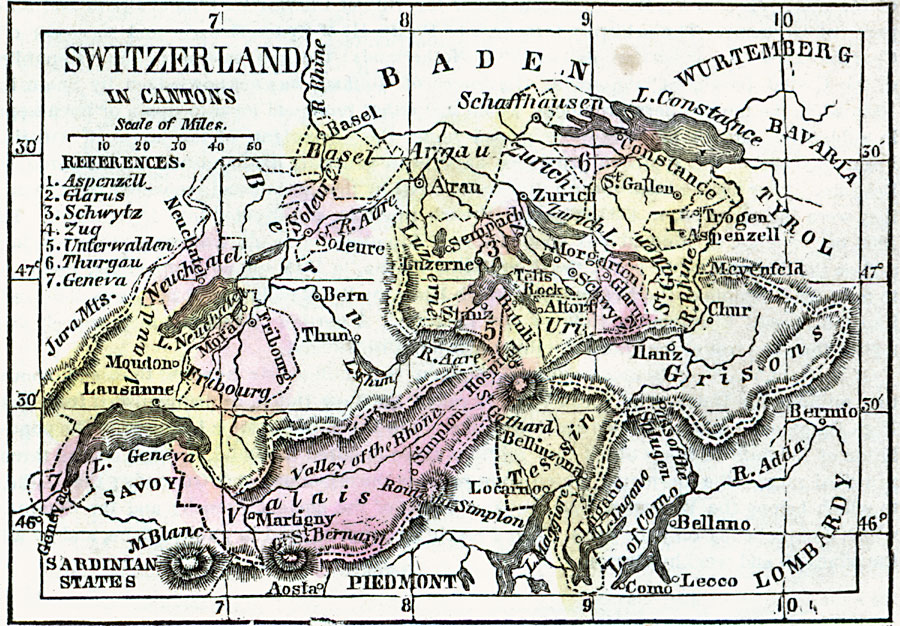
Description: A map of Switzerland in 1859 showing the cantons (states) of Argau (Aargau), Aspenzell (Appenzell), Basel, Bern (Bern and Jura), Fribourg, Geneva, Glarus, Grisons (Graubünden), Luzerne (Lucerne), Neuchatel, Tessin (Nidwalden, Obwalden, and Ticino), Schaffhausen, Schwytz, Soleur (Solothurn), St. Gallen, Thurgau, Uri, Valais, Vaud, Zug, and Zurich.
Place Names: Switzerland, Argau, �Basel, �Constance, �Fribourg, �Lausanne, �Moudon, �Valais, �Zuric
ISO Topic Categories: inlandWaters,
location,
oceans
Keywords: Switzerland in Cantons, borders, �historical, country borders,
county borders, historical event, inlandWaters,
location,
oceans, Unknown, 1859
Source: Marcius Willson, Willson's Outlines of History (New York, NY: Ivison & Phinney, 1859) 591
Map Credit: Courtesy the private collection of Roy Winkelman |
|