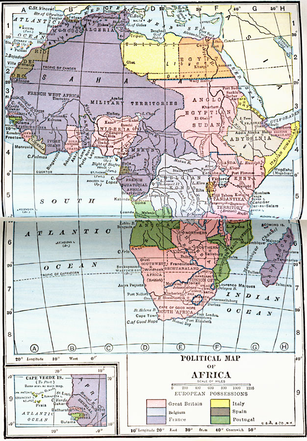
Description: A political map of Africa showing European possessions after WWI and the ceding of German possessions in accordance to the Treaty of Versailles. The inset map details the Cape Verde Islands and Senegal, Gambia, and Portuguese Guinea.
Place Names: A Complete Map of Africa, Nigeria, �Egypt, �South Africa, �Sudan, �Madagascar, �Italian Somaliland, �British Somaliland, �Tripoli, �Belgian Kongo,
ISO Topic Categories: location,
inlandWaters,
oceans,
boundaries
Keywords: European Possessions of Africa, physical, �political, kVersailles, physical features, country borders, location,
inlandWaters,
oceans,
boundaries, Unknown, 1922
Source: , Putnam's Handy Map Book (New York, New York: G. P. Putnam's Sons, 1922) 38-39
Map Credit: Courtesy the private collection of Roy Winkelman |
|