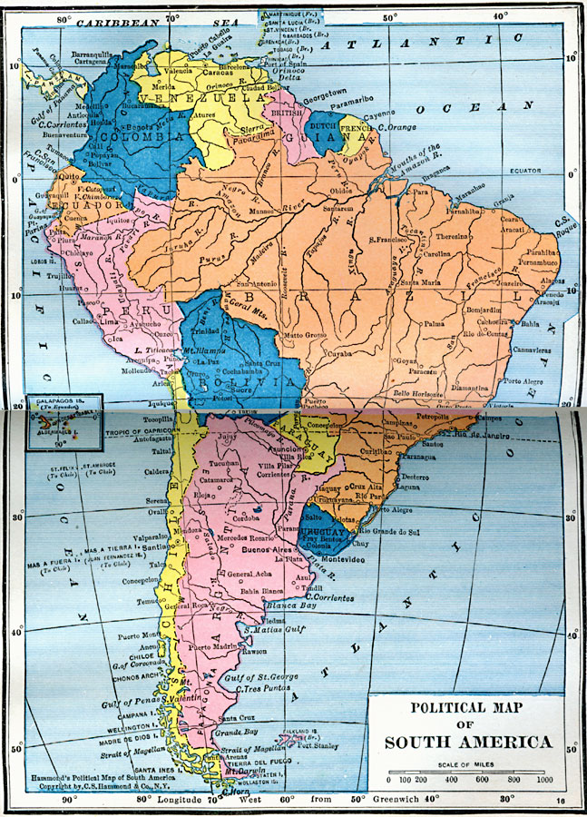
Description: A map of South America from 1922 showing the political boundaries of the time. The map shows capitals, major cities, ports, rivers, and coastal features. An inset map shows the Galapagos Islands.
Place Names: A Complete Map of South America, Brazil, �Chile, �Argentina, �Columbia, �Bolivia, �British Guiana, �Dutch Guiana, �French Guiana, ��Ecuador, �Paraguay, �Uruguay, �Venezuela, �Per
ISO Topic Categories: boundaries,
oceans,
location,
inlandWaters
Keywords: Political Map of South America, physical, �political, physical features, country borders, boundaries,
oceans,
location,
inlandWaters, Unknown, 1922
Source: , Putnam's Handy Map Book (New York, New York: G. P. Putnam's Sons, 1922) 54-55
Map Credit: Courtesy the private collection of Roy Winkelman |
|