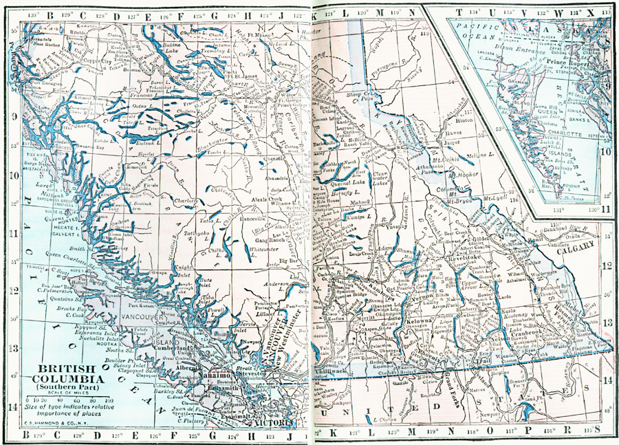
Description: A map from 1922 of the southern part of British Columbia showing the provincial capital of Victoria, major cities and towns, existing and proposed railroads, telegraph lines and submarine cables, mountains, lakes, rivers, coastal features, and islands. An inset map details the Queen Charlotte Island.
Place Names: Canada, British Columbia, �New Westminster, �Vancouve
ISO Topic Categories: boundaries,
inlandWaters,
location,
oceans
Keywords: Southern British Columbia, physical, physical features, boundaries,
inlandWaters,
location,
oceans, Unknown, 1922
Source: , Putnam's Handy Map Book (New York, NY: G. P. Putnam's Sons, 1922) 78-79
Map Credit: Courtesy the private collection of Roy Winkelman |
|