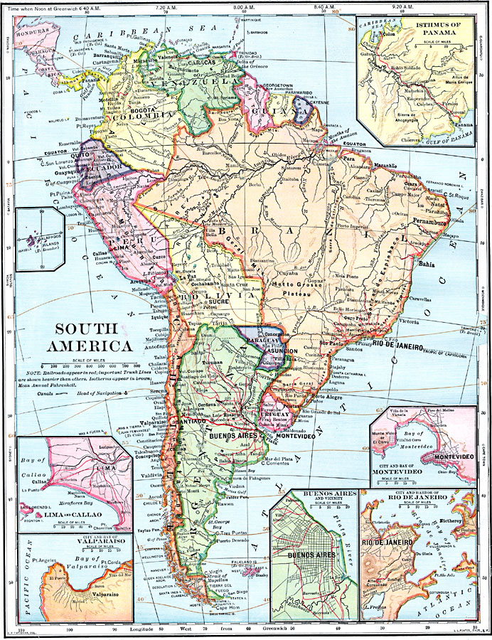
Description: A map from 1902 of South America showing the national boundaries at the time. The map shows capitals, major cities, ports, railroads, canals, rivers, and coastal features. Railroads appear as red lines, with important trunk lines shown heavier than others. Heads of navigation for major rivers is given. Isotherms of mean annual temperatures are shown across the region given in degrees Fahrenheit. Inset maps detail the Isthmus of Panama with the railroad and proposed canal, the Galapagos Islands, and the environs of Lima, Valparaiso, Buenos Aires, Montevideo, and Rio de Janeiro. Time based on noon Greenwich is shown at the top of the map, and latitudinal references to world locations (Madras, Batavia, Samoa Islands, Sydney, Cape Town, Mozambique, Zanzibar, and Cape Guardafui) are shown in the margins.
Place Names: A Complete Map of South America, Argentina, �Bolivia, �Brazil, �Chile, �Columbia, �Ecuador, �Paraguay, �Peru, �Uraguay, �Venezuel
ISO Topic Categories: oceans,
location,
inlandWaters
Keywords: South America, borders, �historical, �transportation, physical features, railroads,
water routes, oceans,
location,
inlandWaters, Unknown, 1902
Source: H. Justin Roddy, Complete Geography (New York, NY: American Book Company, 1902) 86
Map Credit: Courtesy the private collection of Roy Winkelman |
|