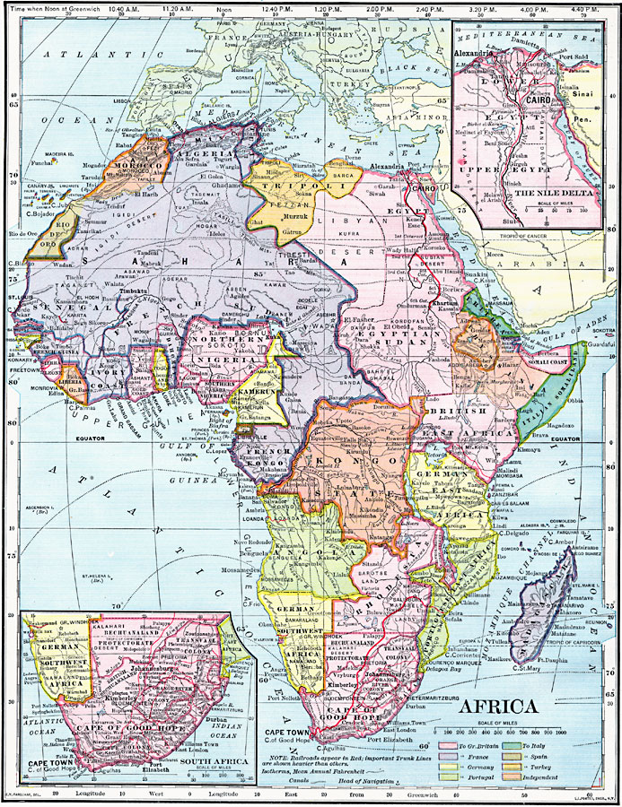
Description: A map of Africa in 1902 showing the European colonial possessions established at the Berlin Conference in 1885, and the Turkish or Ottoman possession of Tripoli. This map shows major cities, rivers, and mountain systems, canals and head of navigation locations, and both important and secondary railroad trunk lines. Isotherms measured in 5 degrees mean annual Fahrenheit are also shown. Inset maps detail the Nile Delta and South Africa.
Place Names: A Complete Map of Africa, Algeria, �Congo, �Egypt, �Ethiopia, �Lybia, �Madagascar, �Nigeria, �Somalia, �South Africa, �Sudan, Cape of Good Hope, Tripoli
ISO Topic Categories: oceans,
location,
inlandWaters
Keywords: Colonial Africa, borders, �historical, �transportation, �meteorological, kBerlinConference, physical features, railroads,
water routes, climate, oceans,
location,
inlandWaters, Unknown, 1902
Source: H. Justin Roddy, Complete Geography (New York, NY: American Book Company, 1902) 128
Map Credit: Courtesy the private collection of Roy Winkelman |
|