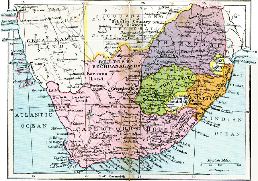
Description: A map of the Union of South Africa in 1920. The Union of South Africa was formed on 31 May, 1910 from the British Cape Colony and Natal, the Boer or Dutch Transvaal and Orange Free State, and the native states of Zulu Land, Basutoland, and Swazi Land. After the Germans ceded German Southwest Africa in accordance with the Treaty of Versailles, the British Walvisch Bay Colony (Walvis Bay) was incorporated into the Union. This map shows cities, ports, and railroads, and the territories of Great Nama Land and the Bechuanaland Protectorate.
Place Names: South Africa, Cape of Good Hope, �British Bechuanaland, �Orange Free State, �Basutoland, �Natal, �Zululand, �Swaziland, �Transvaal, �Kimberley, �Pretoria, �Johannesburg, �Tongald, �Durba
ISO Topic Categories: boundaries,
inlandWaters,
location,
oceans,
transportation
Keywords: Union of South Africa, physical, �political, �transportation, kVersailles, physical features, country borders, railroads, boundaries,
inlandWaters,
location,
oceans,
transportation, Unknown, 1920
Source: , Asprey's Atlas of the World (London, England: Asprey and Co., Ltd., 1920) 106
Map Credit: Courtesy the private collection of Roy Winkelman |
|