Maps Site map
  Maps > Africa > South Africa
Site Map  

  Record   1   to   4  of   4

A collection of historic and contemporary political and physical maps of South Africa, including colonial period maps, for use in the K-12 classroom.
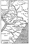
Map of Natal, 1903
A map of the British colony of Natal, which is located in the northeastern part of what is now South Africa. This map shows boundaries, cities, rivers, and topography. "Natal, a British colony on the south–east coast of Africa, situated ne...

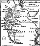
Cape of Good Hope, 1909
A map from 1909 detailing the area around Cape Town and the Cape of Good Hope. The map shows the cities and railroads of the cape, and the prominent mountains and coastal features in the area including Tiger Mountain, Devils Peak, Twelve Apostles, Ha...

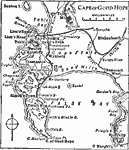
Cape of Good Hope, 1919
A map detailing the area around Cape Town and the Cape of Good Hope around 1919. The map shows the cities and railroads of the cape, and the prominent mountains and coastal features in the area including Tiger Mountain, Devils Peak, Twelve Apostles, ...

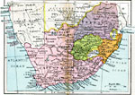
Union of South Africa, 1920
A map of the Union of South Africa in 1920. The Union of South Africa was formed on 31 May, 1910 from the British Cape Colony and Natal, the Boer or Dutch Transvaal and Orange Free State, and the native states of Zulu Land, Basutoland, and Swazi Land...


  Maps > Africa > South Africa
Site Map  

Maps ETC is a part of the Educational Technology Clearinghouse
Produced by the Florida Center for Instructional Technology © 2009
College of Education, University of South Florida