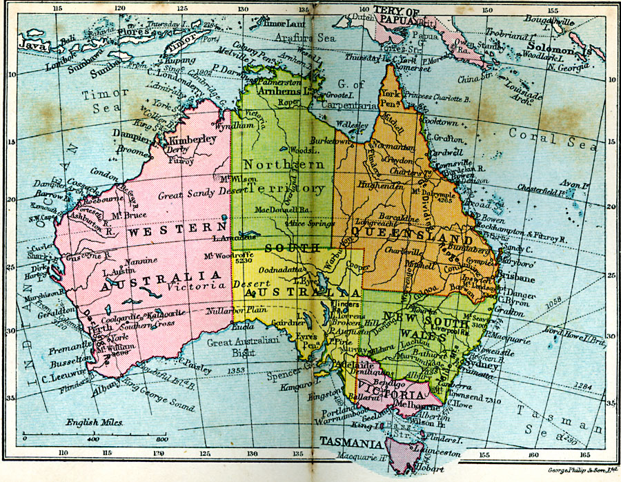
Description: A political map of the Commonwealth of Australia in 1920, showing states and territories, major cities and ports, existing and proposed railways, steamship routes and distances, rivers, and mountain systems.
Place Names: A Complete Map of Australia, Western Australia, �Northern Territory, �South Australia, �Queensland, �New South Wales, �Victoria, �Tasmani
ISO Topic Categories: boundaries,
inlandWaters,
location,
oceans,
transportation
Keywords: Commonwealth of Australia, physical, �political, �transportation, physical features, railroads, boundaries,
inlandWaters,
location,
oceans,
transportation, Unknown, 1920
Source: , Asprey's Atlas of the World (London, England: Asprey and Co., Ltd., 1920) 110
Map Credit: Courtesy the private collection of Roy Winkelman |
|