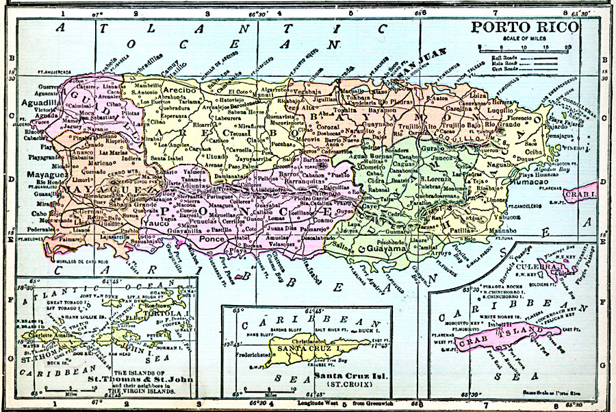
Description: A map from 1920 of Porto Rico (Puerto Rico) with inset maps detailing the Danish West Indies (St. Thomas and St. John) and British Virgin Islands, Santa Cruz (St. Croix), and the islands of Culebra and Crab Island (Isla de Vieques). The map shows the capital of San Juan, major cities and towns, railways, main roads and cart roads, lakes and rivers, mountains, coastal features, and smaller neighboring islands.
Place Names: Puerto Rico, Aguadilla, �Bayamon, �Caguas, �Carolina, �Fajardo, �Guanica, �Guayama, �Mayaguez, �Ponce, �San Jua
ISO Topic Categories: oceans,
inlandWaters,
location
Keywords: Porto Rico, borders, oceans,
inlandWaters,
location, Unknown, 1920
Source: James M. Miller and H.S. Canfield, The People's War Book - History, Cyclopedia, and Chronology of the Great War (Cleveland, OH: R.C. Barnum Co., 1920) 294
Map Credit: Courtesy the private collection of Roy Winkelman |
|