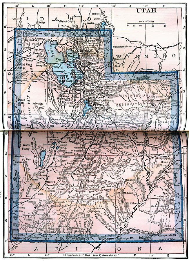
Description: A map from 1922 of Utah showing the capital at Salt Lake City, principal cities and towns, Indian reservations, railroads, mountains, lakes, rivers, and the Great Salt Lake Desert region to the west of Salt Lake.
Place Names: Utah, Provo, �Salt Lake City, �Brigham, �Ogden, �Eureka, �Murray, �Parowan, �St. Georg
ISO Topic Categories: boundaries,
inlandWaters,
location
Keywords: Utah, physical, kNativeAmerican, physical features, boundaries,
inlandWaters,
location, Unknown, 1922
Source: , Putnam's Handy Map Book (New York, NY: G. P. Putnam's Sons, 1922) 302-303
Map Credit: Courtesy the private collection of Roy Winkelman |
|