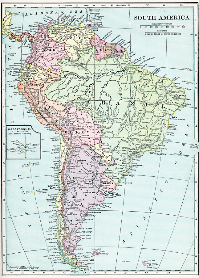
Description: A map of South America from 1920 showing the political boundaries of the time. The map shows capitals, major cities, ports, rivers, terrain, and coastal features. An inset map shows the Galapagos Islands.
Place Names: A Complete Map of South America, Columbia, �Peru, �Argentina, �Brazil, �Bolivia, �Uruguay, �Paraguay, �Chile, �Ecuador, �Venezuela, �Galapagos Islands,
ISO Topic Categories: boundaries,
location,
inlandWaters,
oceans
Keywords: South America, physical, physical features, boundaries,
location,
inlandWaters,
oceans, Unknown, 1920
Source: , Hammond's Modern Atlas of the World (New York, New York: C. S. Hammond and Company, Inc., 1920) 23
Map Credit: Courtesy the private collection of Roy Winkelman |
|