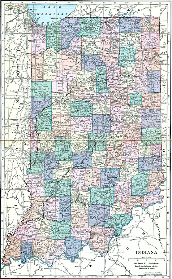
Description: A map from 1920 of Indiana showing the State capital at Indianapolis, counties and county seats, major cities and towns, railroads, and rivers.
Place Names: Indiana, Evansville, �New Albany, �Terre Haute, �La Fayette, �South Bend, �Indianapolis, �Fort Wayne, �Madison, �Columbus, �Lawrencebur
ISO Topic Categories: boundaries,
inlandWaters,
location
Keywords: Indiana, physical, �political, physical features, county borders, boundaries,
inlandWaters,
location, Unknown, 1920
Source: , Hammond's Modern Atlas of the World (New York, NY: C. S. Hammond and Company, Inc., 1920) 90-91
Map Credit: Courtesy the private collection of Roy Winkelman |
|