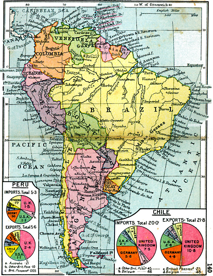
Description: A map of South America from 1920 showing the political boundaries of the time. The map shows capitals, major cities, ports, railways, steamship routes with distances between major ports given in nautical miles, major rivers, and coastal features. British possessions in the Caribbean Sea and Falkland Islands (Islas Malvinas) are underlined in red. This map includes pie–charts showing percentages of major export destinations and import sources for Peru and Chile.
Place Names: A Complete Map of South America, Venezuela, �Colombia, �Ecuador, �Peru, �Guayana, �Brazil, �Bolivia, �Paraguay, �Uruguay, �Argentina, �Chil
ISO Topic Categories: boundaries,
inlandWaters,
location,
oceans
Keywords: South America, physical, �political, physical features, country borders, boundaries,
inlandWaters,
location,
oceans, Unknown, 1920
Source: , Asprey's Atlas of the World (London, England: Asprey and Co., Ltd., 1920) 140
Map Credit: Courtesy the private collection of Roy Winkelman |
|