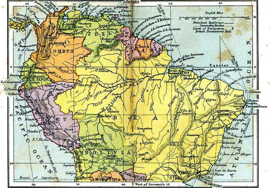
Description: A map from 1920 showing the northern part of South America, including the national borders at the time for Columbia, Venezuela, the Guianas, Ecuador, Peru, Bolivia, and the northern portions of Brazil, Argentina, and Paraguay. The map shows capitals and other major cities, railroads, steamship routes with distances between ports given in nautical miles, rivers and the limits of navigable rivers, terrain, and coastal features of the region. British territories in the Caribbean and Guiana are underlined in red.
Place Names: A Regional Map of South America, Venezuela, �Colombia, �Guiana, �Ecuador, �Peru, �Brazil, �Bolivia, �Paraguay, �Argentin
ISO Topic Categories: boundaries,
inlandWaters,
location,
oceans,
transportation
Keywords: Northern South America, physical, �political, �transportation, physical features, country borders, railroads,
water routes, boundaries,
inlandWaters,
location,
oceans,
transportation, Unknown, 1920
Source: , Asprey's Atlas of the World (London, England: Asprey and Co., Ltd., 1920) 142
Map Credit: Courtesy the private collection of Roy Winkelman |
|