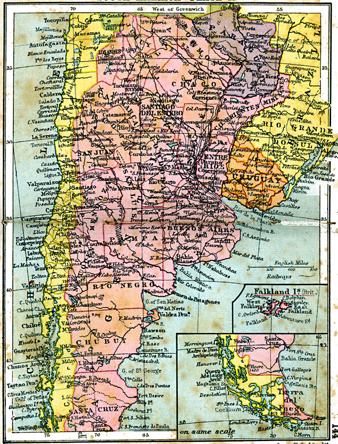
Description: A map from 1920 showing the southern part of South America, including the national, state, and territory borders at the time for Argentina, Paraguay, Uruguay, southern Chile, and southern Brazil. The map shows capitals and other major cities, railroads, rivers, terrain, and coastal features of the region. Inset maps show the continuation of the southern tip of South America to Tierra del Fuego and the Falkland Islands (Islas Malvinas) as a British possession.
Place Names: A Regional Map of South America, Uruguay, �Chile, �Argentina, �Paraguay, �Brazi
ISO Topic Categories: boundaries,
inlandWaters,
location,
oceans,
transportation
Keywords: Southern South America, physical, �political, �transportation, physical features, country borders, railroads, boundaries,
inlandWaters,
location,
oceans,
transportation, Unknown, 1920
Source: , Asprey's Atlas of the World (London, England: Asprey and Co., Ltd., 1920) 144
Map Credit: Courtesy the private collection of Roy Winkelman |
|