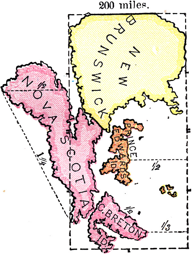
Description: A map exercise from 1872 showing the comparative size of the Canadian Maritime provinces of New Brunswick, Prince Edwards Island, and Nova Scotia with an outline of Kansas (dashed line) overlain at the same map scale. This image is rotated so that north is to the right margin. "Observe that from north to south New Brunswick is the same as Kansas — 200 miles; and the distance between the western part of New Brunswick and the eastern part of Cape Breton is equal to the length of Kansas &mdas; 400 miles." Monteith, 1872, p.20.
Place Names: Canada, New Brunswick, �Prince Edwards Island, �Nova Scotia, �Cape Breton Island,
ISO Topic Categories: boundaries
Keywords: Size of the Maritime Provinces, political, kComparativeArea, county borders, boundaries, Unknown, 1872
Source: James Monteith, Comprehensive Geography (New York, NY: A. S. Barnes and Company, 1872) 20
Map Credit: Courtesy the private collection of Roy Winkelman |
|